The aim of the European Union’s ambitious Marine Strategy Framework Directive (MSFD; Directive 2008/56/EC) is to protect more effectively the marine environment across Europe. Its implementation in the European Atlantic Region (EAR) and the need to extend periodic monitoring programs to offshore waters is very challenging due its surface extension and large deep-water areas. To overcome these difficulties, the iFADO project (innovation in the Framework of the Atlantic Deep Ocean; www.ifado.eu; 2017-2023) combined traditional monitoring with cost-effective state-of-the-art technologies: remote sensing, numerical modelling and emerging observation platforms such as gliders and oceanic buoys.
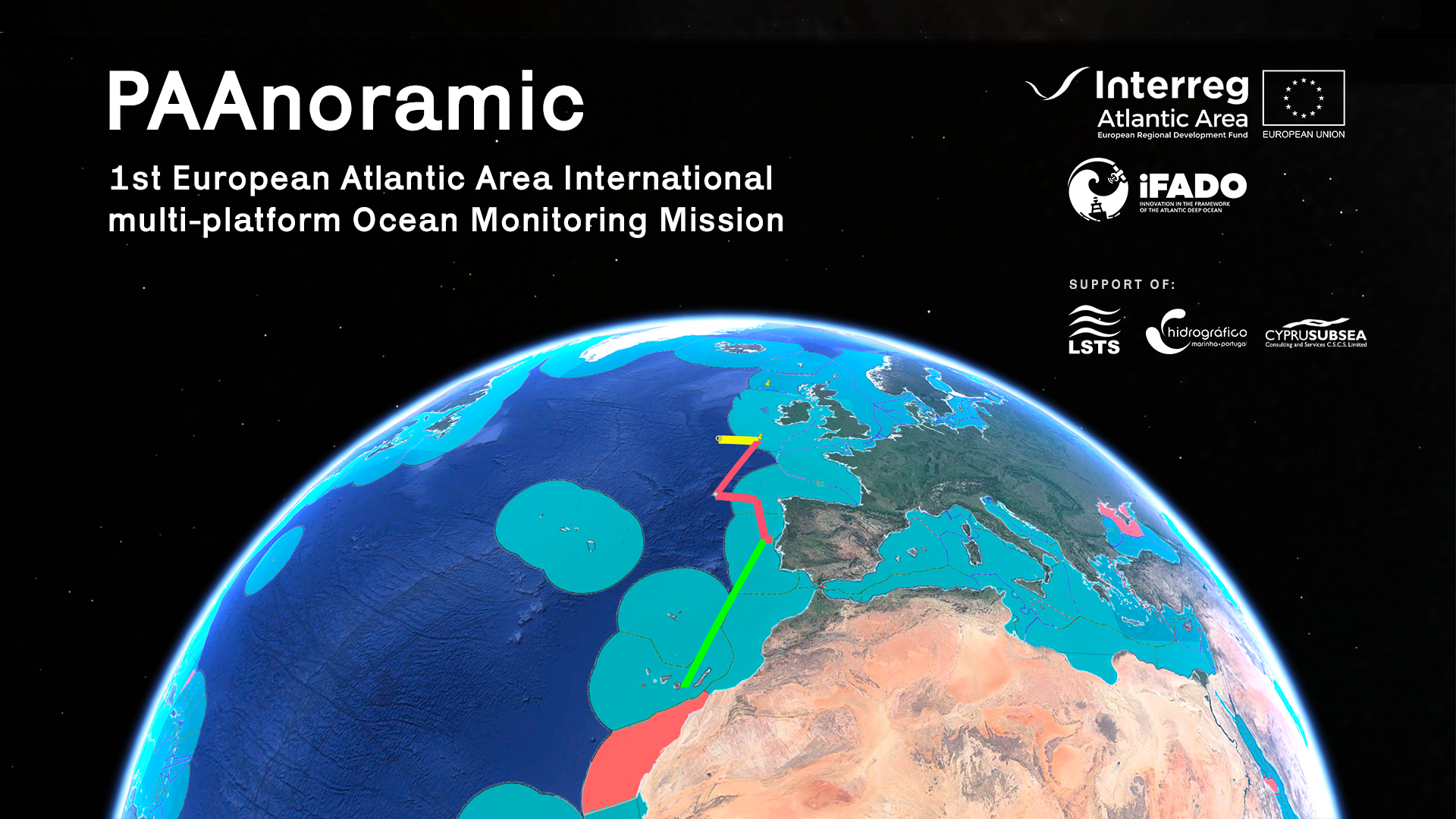
After several successful international glider missions, the consortium proposed a flagship action for the project’s final year: the PAAnoramic mission. This mission will extend to the Atlantic Area, the annual glider endurance line between mainland Portugal and the Canary Islands (Spain), established during the iFADO project since 2018. The PAAnoramic mission covered the European Atlantic façade using autonomous underwater vehicles combined with in-situ monitoring cruises and supported by satellite imagery and operational numerical modelling. This is the first international multi-platform ocean monitoring mission covering the European Atlantic area.
The PAAnoramic glider mission was divided into several sections:
- Marine Institute covered a return transect from the initial release point and the Porcupine Abyssal Plain Sustained Observatory (PAP-SO);
- National Oceanographic Centre covered the section from the Irish coast to Portugal;
- IPMA designed a mission in Western Iberia from the open ocean to the coastal area;
- PLOCAN completes the mission with the route from Portugal to the Canaries.

First two gliders were deployed next to the Irish coast on early December 2022, while a third one was launched in mainland Portugal in May 2023. After its recovery, it will be relaunched during June 2023 to complete the mission in the Canary Islands.
The scientific payload sensors installed in the glider (CTD, DO and fluorometer) will allow collection of data related to physical and biogeochemical essential ocean variables. On their way, the gliders will visit various offshore Marine Protected Areas, such as the Savage Islands and the Gorringe Bank among other seamounts. The mission will also visit some buoys moored in the open ocean such as PAP-SO and the ESTOC (European Station for Time-Series in the Ocean Canary Islands). The mission also demonstrated how gliders can reduce logistics, costs, and risks of ocean monitoring and covering remote areas during harsh weather conditions.
The PAAnoramic mission involved participation of four Atlantic Area countries (Ireland, UK, Portugal and Spain), including two archipelagos (Madeira and Canary Islands). The mission was also supported by two non-iFADO project partners: Cyprus Subsea (Cyprus) and Instituto Hidrográfico (Portugal).
The mission main goal was to demonstrate how international collaboration is key for monitoring the ocean, to implement MSFD, achieve Good Environmental Status, and contribute to the UN Sustainable Development goals such as SDG14. This ambitious action will set a milestone for a future Atlantic Area international unmanned monitoring strategy.
The iFADO PAAnoramic mission: the first European Atlantic area international multi-platform ocean monitoring mission
The aim of the European Union’s ambitious Marine Strategy Framework Directive (MSFD; Directive 2008/56/EC) is to protect more effectively the marine environment across Europe. Its implementation in the European Atlantic Region (EAR) and the need to extend periodic monitoring programs to offshore waters is very challenging due its surface extension and large deep-water areas. To overcome these difficulties, the iFADO project (innovation in the Framework of the Atlantic Deep Ocean; www.ifado.eu; 2017-2023) combined traditional monitoring with cost-effective state-of-the-art technologies: remote sensing, numerical modelling and emerging observation platforms such as gliders and oceanic buoys.
After several successful international glider missions, the consortium proposed a flagship action for the project’s final year: the PAAnoramic mission. This mission will extend to the Atlantic Area, the annual glider endurance line between mainland Portugal and the Canary Islands (Spain), established during the iFADO project since 2018. The PAAnoramic mission covered the European Atlantic façade using autonomous underwater vehicles combined with in-situ monitoring cruises and supported by satellite imagery and operational numerical modelling. This is the first international multi-platform ocean monitoring mission covering the European Atlantic area.
The PAAnoramic glider mission was divided into several sections:
First two gliders were deployed next to the Irish coast on early December 2022, while a third one was launched in mainland Portugal in May 2023. After its recovery, it will be relaunched during June 2023 to complete the mission in the Canary Islands.
The scientific payload sensors installed in the glider (CTD, DO and fluorometer) will allow collection of data related to physical and biogeochemical essential ocean variables. On their way, the gliders will visit various offshore Marine Protected Areas, such as the Savage Islands and the Gorringe Bank among other seamounts. The mission will also visit some buoys moored in the open ocean such as PAP-SO and the ESTOC (European Station for Time-Series in the Ocean Canary Islands). The mission also demonstrated how gliders can reduce logistics, costs, and risks of ocean monitoring and covering remote areas during harsh weather conditions.
The PAAnoramic mission involved participation of four Atlantic Area countries (Ireland, UK, Portugal and Spain), including two archipelagos (Madeira and Canary Islands). The mission was also supported by two non-iFADO project partners: Cyprus Subsea (Cyprus) and Instituto Hidrográfico (Portugal).
The mission main goal was to demonstrate how international collaboration is key for monitoring the ocean, to implement MSFD, achieve Good Environmental Status, and contribute to the UN Sustainable Development goals such as SDG14. This ambitious action will set a milestone for a future Atlantic Area international unmanned monitoring strategy.